Geo-Referenced Load Data Analysis with VMC® GeoLDA

Enhancing Measured Data on Public Roads by Map-Matching the Data to the Digital Road Network

The objective of VMC® GeoLDA (Virtual Measurement Campaign – Geo-referenced Load Data Analysis) is to enrich measurement data collected on public roads in order to gain additional information for the vehicle development process.

Therefore, the measured time series data is mapped to the corresponding digital road segments (map matching). Thus, it is possible to assign properties of the road segments to the segments of the measurement data.

With VMC® GeoLDA, the data is automatically cut into segments according to the operating conditions and the appropriate load data analysis (Rainflow and pseudo-damage calculation) is carried out for each segment.

VMC® GeoLDA supports the user to process extensive measurement data in a fast, efficient, and transparent way. It provides a useful extension to classical LDA software. In addition, VMC® GeoLDA helps to improve the documentation of results and decisions.
Use Cases

Typical applications in vehicle development (passenger cars, VANs, trucks) are:

  • Durability and reliability in the development of suspension, chassis, vehicle body, engine, gearbox, drive train, etc.
  • Energy efficiency in the development of the engine, powertrain and exhaust systems
  • Studying customer behavior with respect to typical driving cycles (fleet data, selected customers, etc.)

Benefits of VMC® GeoLDA

  • Support and improve the planning of real physical measurement campaigns by analyzing the planned routes with respect to relevant environment factors such as road type or topography
  • Saving resources by focusing on covering all operating states of interest (factor level combinations) in a measurement campaign without having to be representative for a particular type of customer
  • Efficient, accurate and automatic processing of large measurement datasets
  • Statistical analyses of the results, e.g. how large is the influence of the factor road type or hilliness on the durability or consumption
  • Extrapolating the data provided by VMC® GeoLDA to different target markets using appropriately adapted usage models (e.g. customer simulation with U·Sim)
  • VMC® GeoLDA is available in two different configurations depending on the customer’s requirements (standalone version without GUI and database connection or fully integrated VMC® module)
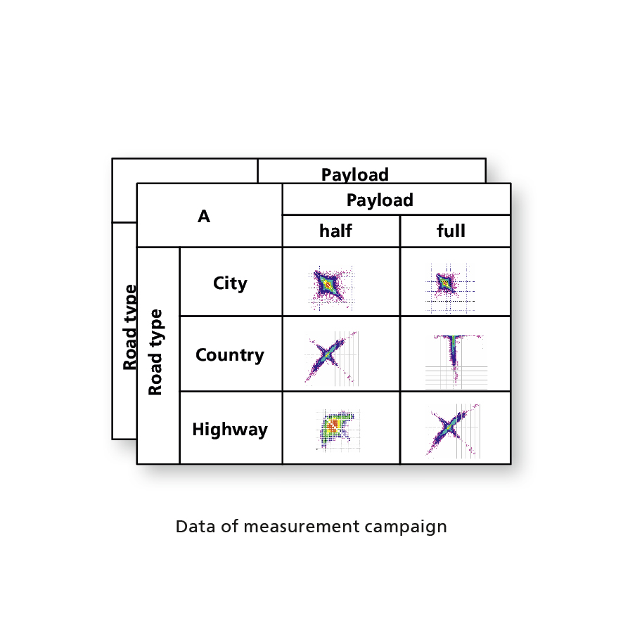
Factor Model with Assigned Measurement Data
© Fraunhofer ITWM
Factor Model with Assigned Measurement Data

Main Features of VMC® GeoLDA

  • Mapping of the route onto the digital road network using the GPS signal and the VMC® road database
  • Segmentation according to the different road types, including the differentiation between urban and rural roads
  • Classification of the road segments (hilliness, curvature)
  • Visualization and evaluation of map matching results
  • Rainflow analysis and pseudo-damage calculation for the segmented time series data
  • Calculation of further quantities on request
  • Numerous data export functions: Diadem, U·Sim, KML, MAT, FIG, PNG, ERFM, XLSX